The picture shows the logo and the words National Park Berchtesgaden next to the small Bavarian coat of arms
  • Home
  • Nature
      • National Park
      • » Goals
      • » Zonation
      • » History
      • » Management
      • » Regulations
      • Facts
      • » Past and present
      • » Habitats
      • » Geology
      • » Flora
      • » Fauna
      • » Climate
      • Awards
      • » IUCN
      • » Europadiplom
      • » EMAS
      • » UN-Dekade
      • » Environmental education
      • » Accessibility
  • Adventure
      • Rules & Notes
      • » Safety in the high mountains
      • » Accessibility of the paths
      • » Mountain huts & pastures
      • » Behaviour rules
      • » Climbing concept
      • » Paraglider
      • Tips for on the go
      • » Barrier free
      • » Hike
      • » Bike
      • » Winter tours
      • » Outside to the toilet
      • Events
      • » Hiking program
  • Education
      • For groups
      • » General information
      • » Nursery school and elementary schools
      • » Secondary schools
      • » Adults
      • » Guided tours through the exhibition
      • Partner schools
      • » About the project
      • » Events & school projects
      • » Participating schools
      • » Newsletter
      • » Alpine School
      • » Material
  • Research
      • Projects
      • » Ongoing
      • » Finished
      • Data
      • » Working group
      • » Basic data
      • Monitoring
      • » Golden eagle
      • » Bearded vulture
      • » Climate
      • » Spring
      • » Biodiversity
      • » Forest Intensive Plot
      • Cooperations
      • » TU München
      • » Climate
      • » Ecosystems
      • » Application
  • Infopoints
      • Haus der Berge
      • » Information center
      • » Temporary exhibitions
      • » Education Centre
      • » Outdoor area
      • » Gastronomy
      • National Park
      • » Hintersee
      • » Wimbachbrücke
      • » Jenner mountain station
      • » St. Bartholomä
      • » Kühroint
      • » Engert-Holzstube
      • Other facilities
      • » Carrion ecology
      • » Observation Point
      • » Deer Feeding
      • » Suspension bridge
      • » Mobile stands
      • » Info2go
      • » Actionbound
  • Service
      • About us
      • » Contact
      • » Organization chart
      • » Contact Person
      • » Offices
      • » Cooperations
      • Getting there
      • » On foot
      • » By bus & train
      • » By car
      • Partner
      • » Partner initiative
      • » National Park Partner
      • » Biosphere Region
      • » More service links
      • Publications
      • » Programs
      • » Research reports
      • » Peer reviewed
      • Press
      • » Filming permits
      • » Press releases
      • » Press Photos
      • Media library
      • » Webcams
      • » Photos
      • » Videos
      • » App
      • General
      • » Imprint
      • » Accessibility
      • » Sign language
      • » Visual aid
      • » Font size
      • » Color contrast
      • » Contact
      • » Sitemap
      • » Netiquette
      • » FAQ
  • Startseite >> 
  • English >> 
  • Adventure >> 
  • Tips >> 
  • Hike

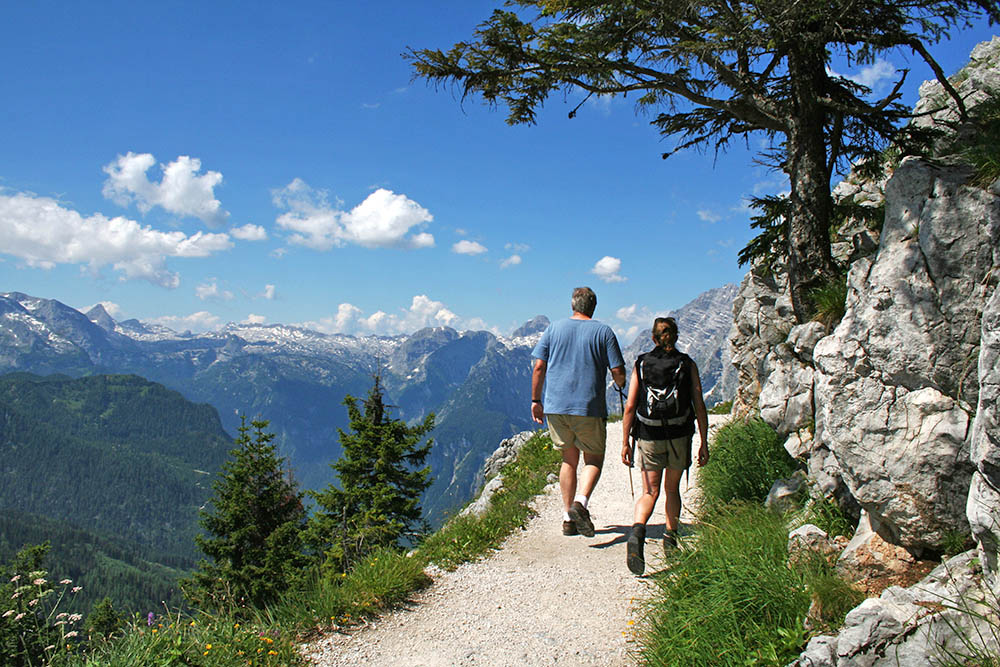
Hiking and mountaineering

Hiking in Berchtesgaden National Park has many faces: some prefer a leisurely stroll through the valley, while others seek the challenge of a high mountain peak.

The Berchtesgaden National Park offers a varied network of 260 km of hiking trails and alpine paths - there is something for everyone. The hiking trails are divided into the categories barrier-free, easy, medium and difficult. Maps for route planning are available at the national park information points, in bookshops or online.


Hiker on the Jenner


The hiking trail network in the national park

Map legend


Tips for a safe and unforgettable stay

  • Be sure to tailor your excursions to your personal ability and to the weather and daylight conditions
  • Make sure you wear sturdy footwear and take rain protection, warm clothing, drinks and sufficient food with you
  • Pay attention to current conditions in the terrain - the weather can change very quickly in the mountains
  • Rely on detailed maps and signposting in the terrain when planning your route and orientation
  • For longer tours and on more difficult paths, a head for heights, surefootedness and good physical condition are essential
  • In winter, always pay attention to the avalanche report
  • Follow the rules - this way you can make a valuable contribution to the protection of nature and a great experience for everyone!

Under “Safety in the high mountains” we have compiled some additional information for you on how to be safe in the National Park and under “Accessibility of the trails” you will find current closures.


Tour suggestions

Please note that the difficulty ratings may differ depending on the tour portal. The evaluation criteria of the tour portals usually refer to the distance/calculated walking time of the tour, the altitude difference and the technical difficulty based on the SAC hiking scale. Therefore, in addition to the tour data (e.g. length, altitude), please also give priority to the signposts in the terrain.

These refer to the difficulty of the individual sections of the trail and, in contrast to the tour portals, are based on the following categories:

  • Easy mountain trails (blue) are often narrow and can have steep passages; there is no danger of falling.
  • Medium-difficulty trails (red) are narrow and usually steep. Short passages with a risk of falling or sections secured by wire ropes must be mastered.
  • Difficult climbs (black) are narrow, steep, often exposed and there is a risk of falling. Wire rope secured passages and unsecured climbing sections must be mastered. Not suitable for dogs.

Your tour planning should be adapted to your physical condition, which is why we ask you to always take all factors into account and not to ignore the signs in the terrain!


Help to protect the sensitive mountain nature!

In a national park, the protection of nature is the primary goal. And for this to work, we need your help! Please adhere to the following rules to protect chamois, marmots and co:

  • Take garbage back home with you
  • Do not pick plants
  • Keep dogs on a lead in the national park
  • Stay on the paths - please do not walk cross-country or take shortcuts
  • Do not disturb wild animals
  • Do not camp or bivouac
  • Do not light campfires
  • Do not make noise
  • Air mattresses, rubber boats and other flotation devices are prohibited
  • Drones are not allowed to fly in the national park
  • Cyclists must show consideration for hikers


Thank you for your understanding and for taking part!

Adventure

Rules & Notes

  • Safety in the high mountains
  • Accessibility of the paths
  • Mountain huts & pastures
  • Behaviour rules
  • Climbing concept
  • Paraglider

Tips for on the go

  • Barrier free
  • Hike
  • Bike
  • Winter tours
  • Outside to the toilet

Events

  • Hiking program

Information Center

  • Logo Haus der Berge

  • +49 8652 979060-0
  • hausderberge@npv-bgd.bayern.de
  • Hanielstraße 7
    83471 Berchtesgaden

National Park Administration


  • +49 8652 9686-0
  • poststelle@npv-bgd.bayern.de
  • Doktorberg 6
    83471 Berchtesgaden

Service

  • FAQ

Awards

  • Logo IUCN II Logo Europadiplom Logo EMAS Logo UN-Dekade Logo Environmental Education Bavaria Logo Barrier-free Bavaria


Social Media

Visit us at Social Media


Deutsche Version

  • Deutschlands einziger Alpen-Nationalpark

Berchtesgaden National Park - Privacy | Imprint | Sitemap | Contact